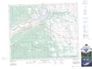
Maps showing Sibbald Flat, 13-24-7-W5, Alberta
Sibbald Flat is a Beach located in 13-24-7-W5, Alberta and has an elevation of 1475 meters.
- Latitude: 51° 2' 36'' North (decimal: 51.0433333)
- Longitude: 114° 50' 58'' West (decimal: -114.8494444)
- Topography Feature Category: Beach
- Geographical Feature: Flat
- Canadian Province/Territory: Alberta
- Elevation: 1475 meters
- Location: 13-24-7-W5
- Atlas of Canada Locator Map: Sibbald Flat
- GPS Coordinate Locator Map: Sibbald Flat Lat/Long
Sibbald Flat NTS Map Sheets