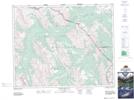
Maps showing Skeleton Lake, 30-14-W5, Alberta
Skeleton Lake is a Lake located in 30-14-W5, Alberta and has an elevation of 1892 meters.
- Latitude: 51° 36' 44'' North (decimal: 51.6122221)
- Longitude: 115° 55' 47'' West (decimal: -115.9297221)
- Topography Feature Category: Lake
- Geographical Feature: Lake
- Canadian Province/Territory: Alberta
- Elevation: 1892 meters
- Location: 30-14-W5
- Atlas of Canada Locator Map: Skeleton Lake
- GPS Coordinate Locator Map: Skeleton Lake Lat/Long
Skeleton Lake NTS Map Sheets