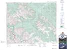
Maps showing Harrison Flats, 25,26-33-14-W5, Alberta
Harrison Flats is a Low vegetation located in 25,26-33-14-W5, Alberta and has an elevation of 1718 meters.
- Latitude: 51° 51' 55'' North (decimal: 51.8652777)
- Longitude: 115° 52' 25'' West (decimal: -115.8736111)
- Topography Feature Category: Low vegetation
- Geographical Feature: Meadow
- Canadian Province/Territory: Alberta
- Elevation: 1718 meters
- Location: 25,26-33-14-W5
- Atlas of Canada Locator Map: Harrison Flats
- GPS Coordinate Locator Map: Harrison Flats Lat/Long
Harrison Flats NTS Map Sheets