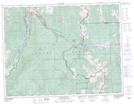
Maps showing Hazell, 7-8-5-W5, Alberta
Hazell is a Unincorporated area located in 7-8-5-W5, Alberta and has an elevation of 1440 meters.
- Latitude: 49° 37' 48'' North (decimal: 49.6299999)
- Longitude: 114° 39' 52'' West (decimal: -114.6644443)
- Topography Feature Category: Unincorporated area
- Geographical Feature: Hamlet
- Canadian Province/Territory: Alberta
- Elevation: 1440 meters
- Location: 7-8-5-W5
- Atlas of Canada Locator Map: Hazell
- GPS Coordinate Locator Map: Hazell Lat/Long