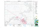
Maps showing Brush Flats, 15-5-W4, Alberta
Brush Flats is a Plain located in 15-5-W4, Alberta and has an elevation of 633 meters.
- Latitude: 50° 15' 15'' North (decimal: 50.2541667)
- Longitude: 110° 38' 56'' West (decimal: -110.6488889)
- Topography Feature Category: Plain
- Geographical Feature: Flats
- Canadian Province/Territory: Alberta
- Elevation: 633 meters
- Location: 15-5-W4
- Atlas of Canada Locator Map: Brush Flats
- GPS Coordinate Locator Map: Brush Flats Lat/Long
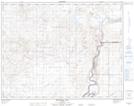
Brush Flats NTS Map Sheets