Canada Topographic Maps

Bullshead Creek Topo Maps

Topography maps and Latitude/Longitude Location

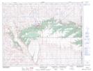
Maps showing Bullshead Creek, 32-12-5-W4, Alberta

Bullshead Creek is a River located in 32-12-5-W4, Alberta and has an elevation of 845 meters.

  • Latitude: 50° 0' 14'' North   (decimal: 50.0038888)
  • Longitude: 110° 37' 4'' West   (decimal: -110.6177778)
  • Topography Feature Category: River
  • Geographical Feature: Creek
  • Canadian Province/Territory: Alberta
  • Elevation: 845 meters
  • Location: 32-12-5-W4
  • Atlas of Canada Locator Map: Bullshead Creek
  • GPS Coordinate Locator Map: Bullshead Creek Lat/Long

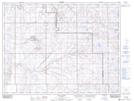
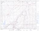
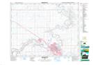
Bullshead Creek NTS Map Sheets

072E09 Elkwater Lake Topographic Map at 1:50,000 scale

072E10 Bulls Head Topographic Map at 1:50,000 scale

072E15 Seven Persons Topographic Map at 1:50,000 scale

072L02 Medicine Hat Topographic Map at 1:50,000 scale

072E Foremost Topographic Map at 1:250,000 scale

072L Medicine Hat Topographic Map at 1:250,000 scale

 
Buy Topographic Maps DVD
Newsletter Sign-up

Yes, I want to receive map store discounts.


Bookmark and Share