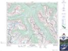
Maps showing Snowbird Glacier, 32-19-W5, Alberta
Snowbird Glacier is a Glacier located in 32-19-W5, Alberta and has an elevation of 2611 meters.
- Latitude: 51° 45' 27'' North (decimal: 51.7575000)
- Longitude: 116° 34' 21'' West (decimal: -116.5724999)
- Topography Feature Category: Glacier
- Geographical Feature: Glacier
- Canadian Province/Territory: Alberta
- Elevation: 2611 meters
- Location: 32-19-W5
- Atlas of Canada Locator Map: Snowbird Glacier
- GPS Coordinate Locator Map: Snowbird Glacier Lat/Long
Snowbird Glacier NTS Map Sheets