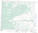
Maps showing Hinton Trail, 13-70-11-W6, Alberta
Hinton Trail is a Unincorporated area located in 13-70-11-W6, Alberta and has an elevation of 712 meters.
- Latitude: 55° 3' 15'' North (decimal: 55.0541666)
- Longitude: 119° 31' 34'' West (decimal: -119.5261110)
- Topography Feature Category: Unincorporated area
- Geographical Feature: Former Post Office
- Canadian Province/Territory: Alberta
- Elevation: 712 meters
- Location: 13-70-11-W6
- Atlas of Canada Locator Map: Hinton Trail
- GPS Coordinate Locator Map: Hinton Trail Lat/Long
Hinton Trail NTS Map Sheets