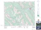
Maps showing Standish Ridge, 24-13-W5, Alberta
Standish Ridge is a Mountain located in 24-13-W5, Alberta and has an elevation of 2323 meters.
- Latitude: 51° 4' 17'' North (decimal: 51.0713888)
- Longitude: 115° 47' 14'' West (decimal: -115.7872222)
- Topography Feature Category: Mountain
- Geographical Feature: Ridge
- Canadian Province/Territory: Alberta
- Elevation: 2323 meters
- Location: 24-13-W5
- Atlas of Canada Locator Map: Standish Ridge
- GPS Coordinate Locator Map: Standish Ridge Lat/Long