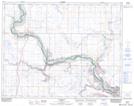
Maps showing Steveville, 4-22-12-W4, Alberta
Steveville is a Unincorporated area located in 4-22-12-W4, Alberta and has an elevation of 649 meters.
- Latitude: 50° 50' 18'' North (decimal: 50.8383333)
- Longitude: 111° 36' 4'' West (decimal: -111.6011110)
- Topography Feature Category: Unincorporated area
- Geographical Feature: Locality
- Canadian Province/Territory: Alberta
- Elevation: 649 meters
- Location: 4-22-12-W4
- Atlas of Canada Locator Map: Steveville
- GPS Coordinate Locator Map: Steveville Lat/Long
Steveville NTS Map Sheets