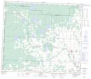
Maps showing Hythe, 13-73-11-W6, Alberta
Hythe is a Village located in 13-73-11-W6, Alberta and has an elevation of 746 meters.
- Latitude: 55° 19' 38'' North (decimal: 55.3272222)
- Longitude: 119° 33' 14'' West (decimal: -119.5538888)
- Topography Feature Category: Village
- Geographical Feature: Village
- Canadian Province/Territory: Alberta
- Elevation: 746 meters
- Location: 13-73-11-W6
- Atlas of Canada Locator Map: Hythe
- GPS Coordinate Locator Map: Hythe Lat/Long
Hythe NTS Map Sheets