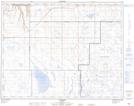
Maps showing Iddesleigh, 34-20-10-W4, Alberta
Iddesleigh is a Unincorporated area located in 34-20-10-W4, Alberta and has an elevation of 786 meters.
- Latitude: 50° 44' 8'' North (decimal: 50.7355555)
- Longitude: 111° 18' 11'' West (decimal: -111.3030556)
- Topography Feature Category: Unincorporated area
- Geographical Feature: Locality
- Canadian Province/Territory: Alberta
- Elevation: 786 meters
- Location: 34-20-10-W4
- Atlas of Canada Locator Map: Iddesleigh
- GPS Coordinate Locator Map: Iddesleigh Lat/Long
Iddesleigh NTS Map Sheets