Canada Topographic Maps

Sundance Range Topo Maps

Topography maps and Latitude/Longitude Location

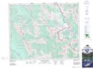
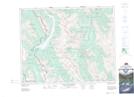
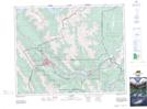
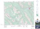
Maps showing Sundance Range, Alberta

Sundance Range is a Mountain located in Alberta and has an elevation of 2349 meters.

  • Latitude: 51° 2' 35'' North   (decimal: 51.0430555)
  • Longitude: 115° 34' 17'' West   (decimal: -115.5713888)
  • Topography Feature Category: Mountain
  • Geographical Feature: Range
  • Canadian Province/Territory: Alberta
  • Elevation: 2349 meters
  • Atlas of Canada Locator Map: Sundance Range
  • GPS Coordinate Locator Map: Sundance Range Lat/Long

Sundance Range NTS Map Sheets

082J13 Mount Assiniboine Topographic Map at 1:50,000 scale

082J14 Spray Lakes Reservoir Topographic Map at 1:50,000 scale

082O03 Canmore Topographic Map at 1:50,000 scale

082O04 Banff Topographic Map at 1:50,000 scale

082J Kananaskis Lakes Topographic Map at 1:250,000 scale

082O Calgary Topographic Map at 1:250,000 scale

 
Buy Topographic Maps DVD
Newsletter Sign-up

Yes, I want to receive map store discounts.


Bookmark and Share