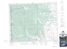
Maps showing Jackass Canyon, 32-26-5-W5, Alberta
Jackass Canyon is a Valley located in 32-26-5-W5, Alberta and has an elevation of 1325 meters.
- Latitude: 51° 15' 45'' North (decimal: 51.2625000)
- Longitude: 114° 39' 52'' West (decimal: -114.6644443)
- Topography Feature Category: Valley
- Geographical Feature: Canyon
- Canadian Province/Territory: Alberta
- Elevation: 1325 meters
- Location: 32-26-5-W5
- Atlas of Canada Locator Map: Jackass Canyon
- GPS Coordinate Locator Map: Jackass Canyon Lat/Long
Jackass Canyon NTS Map Sheets