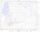
Maps showing Jackfish Bay, 17-14-W4, Alberta
Jackfish Bay is a Bay located in 17-14-W4, Alberta and has an elevation of 767 meters.
- Latitude: 50° 25' 17'' North (decimal: 50.4213888)
- Longitude: 111° 54' 10'' West (decimal: -111.9027777)
- Topography Feature Category: Bay
- Geographical Feature: Bay
- Canadian Province/Territory: Alberta
- Elevation: 767 meters
- Location: 17-14-W4
- Atlas of Canada Locator Map: Jackfish Bay
- GPS Coordinate Locator Map: Jackfish Bay Lat/Long
Jackfish Bay NTS Map Sheets