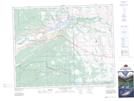
Maps showing Jacob Creek, 6-26-6-W5, Alberta
Jacob Creek is a River located in 6-26-6-W5, Alberta and has an elevation of 1292 meters.
- Latitude: 51° 11' 21'' North (decimal: 51.1891666)
- Longitude: 114° 49' 18'' West (decimal: -114.8216666)
- Topography Feature Category: River
- Geographical Feature: Creek
- Canadian Province/Territory: Alberta
- Elevation: 1292 meters
- Location: 6-26-6-W5
- Atlas of Canada Locator Map: Jacob Creek
- GPS Coordinate Locator Map: Jacob Creek Lat/Long
Jacob Creek NTS Map Sheets