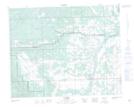
Maps showing James River Bridge, 27-34-5-W5, Alberta
James River Bridge is a Unincorporated area located in 27-34-5-W5, Alberta and has an elevation of 1098 meters.
- Latitude: 51° 56' 27'' North (decimal: 51.9408333)
- Longitude: 114° 38' 18'' West (decimal: -114.6383332)
- Topography Feature Category: Unincorporated area
- Geographical Feature: Locality
- Canadian Province/Territory: Alberta
- Elevation: 1098 meters
- Location: 27-34-5-W5
- Atlas of Canada Locator Map: James River Bridge
- GPS Coordinate Locator Map: James River Bridge Lat/Long