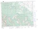
Maps showing Christie Mine Ridge, 2,3,9,10-5-1-W5, Alberta
Christie Mine Ridge is a Mountain located in 2,3,9,10-5-1-W5, Alberta.
- Latitude: 49° 22' 8'' North (decimal: 49.3688888)
- Longitude: 114° 4' 17'' West (decimal: -114.0713888)
- Topography Feature Category: Mountain
- Geographical Feature: Ridge
- Canadian Province/Territory: Alberta
- Location: 2,3,9,10-5-1-W5
- Atlas of Canada Locator Map: Christie Mine Ridge
- GPS Coordinate Locator Map: Christie Mine Ridge Lat/Long
Christie Mine Ridge NTS Map Sheets