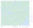
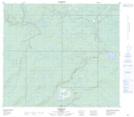
Maps showing Christina Lake, 76-6,7-W4, Alberta
Christina Lake is a Lake located in 76-6,7-W4, Alberta and has an elevation of 558 meters.
- Latitude: 55° 37' 21'' North (decimal: 55.6225000)
- Longitude: 110° 52' 42'' West (decimal: -110.8783332)
- Topography Feature Category: Lake
- Geographical Feature: Lake
- Canadian Province/Territory: Alberta
- Elevation: 558 meters
- Location: 76-6,7-W4
- Atlas of Canada Locator Map: Christina Lake
- GPS Coordinate Locator Map: Christina Lake Lat/Long
Christina Lake NTS Map Sheets