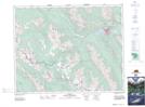
Maps showing Citadel Pass, 24-13-W5, Alberta
Citadel Pass is a Valley located in 24-13-W5, Alberta and has an elevation of 2386 meters.
- Latitude: 51° 1' 13'' North (decimal: 51.0202777)
- Longitude: 115° 42' 37'' West (decimal: -115.7102778)
- Topography Feature Category: Valley
- Geographical Feature: Pass
- Canadian Province/Territory: Alberta
- Elevation: 2386 meters
- Location: 24-13-W5
- Atlas of Canada Locator Map: Citadel Pass
- GPS Coordinate Locator Map: Citadel Pass Lat/Long