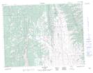
Maps showing Thunder Mountain, 10-3-W5, Alberta
Thunder Mountain is a Mountain located in 10-3-W5, Alberta and has an elevation of 2124 meters.
- Latitude: 49° 50' 20'' North (decimal: 49.8388889)
- Longitude: 114° 21' 30'' West (decimal: -114.3583332)
- Topography Feature Category: Mountain
- Geographical Feature: Mountain
- Canadian Province/Territory: Alberta
- Elevation: 2124 meters
- Location: 10-3-W5
- Atlas of Canada Locator Map: Thunder Mountain
- GPS Coordinate Locator Map: Thunder Mountain Lat/Long