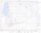
Maps showing Tilley, 19-17-12-W4, Alberta
Tilley is a Village located in 19-17-12-W4, Alberta and has an elevation of 752 meters.
- Latitude: 50° 27' 8'' North (decimal: 50.4522221)
- Longitude: 111° 39' 12'' West (decimal: -111.6533332)
- Topography Feature Category: Village
- Geographical Feature: Village
- Canadian Province/Territory: Alberta
- Elevation: 752 meters
- Location: 19-17-12-W4
- Atlas of Canada Locator Map: Tilley
- GPS Coordinate Locator Map: Tilley Lat/Long
Tilley NTS Map Sheets