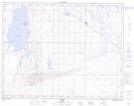
Maps showing Tilley Slough, 17,18-12-W4, Alberta
Tilley Slough is a Lake located in 17,18-12-W4, Alberta and has an elevation of 745 meters.
- Latitude: 50° 27' 56'' North (decimal: 50.4655555)
- Longitude: 111° 37' 25'' West (decimal: -111.6236111)
- Topography Feature Category: Lake
- Geographical Feature: Slough
- Canadian Province/Territory: Alberta
- Elevation: 745 meters
- Location: 17,18-12-W4
- Atlas of Canada Locator Map: Tilley Slough
- GPS Coordinate Locator Map: Tilley Slough Lat/Long
Tilley Slough NTS Map Sheets