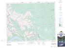
Maps showing Mount Oliver, 28-11-W5, Alberta
Mount Oliver is a Mountain located in 28-11-W5, Alberta and has an elevation of 2699 meters.
- Latitude: 51° 25' 39'' North (decimal: 51.4274166)
- Longitude: 115° 28' 32'' West (decimal: -115.4755832)
- Topography Feature Category: Mountain
- Geographical Feature: Mount
- Canadian Province/Territory: Alberta
- Elevation: 2699 meters
- Location: 28-11-W5
- Atlas of Canada Locator Map: Mount Oliver
- GPS Coordinate Locator Map: Mount Oliver Lat/Long
Mount Oliver NTS Map Sheets