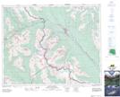
Maps showing Consolation Valley, 27-16-W5, Alberta
Consolation Valley is a Valley located in 27-16-W5, Alberta and has an elevation of 2014 meters.
- Latitude: 51° 19' 18'' North (decimal: 51.3216667)
- Longitude: 116° 9' 10'' West (decimal: -116.1527777)
- Topography Feature Category: Valley
- Geographical Feature: Valley
- Canadian Province/Territory: Alberta
- Elevation: 2014 meters
- Location: 27-16-W5
- Atlas of Canada Locator Map: Consolation Valley
- GPS Coordinate Locator Map: Consolation Valley Lat/Long