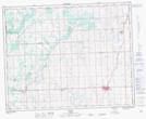
Maps showing Netook, 34-33-1-W5, Alberta
Netook is a Unincorporated area located in 34-33-1-W5, Alberta and has an elevation of 1007 meters.
- Latitude: 51° 52' 42'' North (decimal: 51.8783333)
- Longitude: 114° 2' 59'' West (decimal: -114.0497222)
- Topography Feature Category: Unincorporated area
- Geographical Feature: Locality
- Canadian Province/Territory: Alberta
- Elevation: 1007 meters
- Location: 34-33-1-W5
- Atlas of Canada Locator Map: Netook
- GPS Coordinate Locator Map: Netook Lat/Long