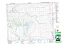
Maps showing Nier, 23-28-2-W5, Alberta
Nier is a Unincorporated area located in 23-28-2-W5, Alberta and has an elevation of 1153 meters.
- Latitude: 51° 24' 50'' North (decimal: 51.4138889)
- Longitude: 114° 10' 5'' West (decimal: -114.1680555)
- Topography Feature Category: Unincorporated area
- Geographical Feature: Locality
- Canadian Province/Territory: Alberta
- Elevation: 1153 meters
- Location: 23-28-2-W5
- Atlas of Canada Locator Map: Nier
- GPS Coordinate Locator Map: Nier Lat/Long