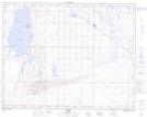
Maps showing Timko Lake (Bantry Reservoir), 17-13-W4, Alberta
Timko Lake (Bantry Reservoir) is a Lake located in 17-13-W4, Alberta and has an elevation of 757 meters.
- Latitude: 50° 28' 34'' North (decimal: 50.4761111)
- Longitude: 111° 44' 00'' West (decimal: -111.7333332)
- Topography Feature Category: Lake
- Geographical Feature: Reservoir
- Canadian Province/Territory: Alberta
- Elevation: 757 meters
- Location: 17-13-W4
- Atlas of Canada Locator Map: Timko Lake (Bantry Reservoir)
- GPS Coordinate Locator Map: Timko Lake (Bantry Reservoir) Lat/Long
Timko Lake (Bantry Reservoir) NTS Map Sheets