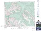
Maps showing Tomahawk Mountain, 32-13,14-W5, Alberta
Tomahawk Mountain is a Mountain located in 32-13,14-W5, Alberta and has an elevation of 2719 meters.
- Latitude: 51° 45' 42'' North (decimal: 51.7616666)
- Longitude: 115° 48' 56'' West (decimal: -115.8155556)
- Topography Feature Category: Mountain
- Geographical Feature: Mountain
- Canadian Province/Territory: Alberta
- Elevation: 2719 meters
- Location: 32-13,14-W5
- Atlas of Canada Locator Map: Tomahawk Mountain
- GPS Coordinate Locator Map: Tomahawk Mountain Lat/Long
Tomahawk Mountain NTS Map Sheets