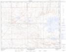
Maps showing Vale, 6-15-3-W4, Alberta
Vale is a Unincorporated area located in 6-15-3-W4, Alberta and has an elevation of 766 meters.
- Latitude: 50° 13' 23'' North (decimal: 50.2230555)
- Longitude: 110° 23' 26'' West (decimal: -110.3905556)
- Topography Feature Category: Unincorporated area
- Geographical Feature: Settlement
- Canadian Province/Territory: Alberta
- Elevation: 766 meters
- Location: 6-15-3-W4
- Atlas of Canada Locator Map: Vale
- GPS Coordinate Locator Map: Vale Lat/Long
Vale NTS Map Sheets