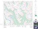
Maps showing Crowfoot Mountain, 31-18-W5, Alberta
Crowfoot Mountain is a Mountain located in 31-18-W5, Alberta and has an elevation of 2686 meters.
- Latitude: 51° 38' 35'' North (decimal: 51.6430555)
- Longitude: 116° 27' 16'' West (decimal: -116.4544444)
- Topography Feature Category: Mountain
- Geographical Feature: Mountain
- Canadian Province/Territory: Alberta
- Elevation: 2686 meters
- Location: 31-18-W5
- Atlas of Canada Locator Map: Crowfoot Mountain
- GPS Coordinate Locator Map: Crowfoot Mountain Lat/Long