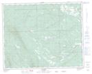
Maps showing Vetch Creek, 37-8-W5, Alberta
Vetch Creek is a River located in 37-8-W5, Alberta and has an elevation of 1240 meters.
- Latitude: 52° 12' 45'' North (decimal: 52.2124999)
- Longitude: 115° 4' 54'' West (decimal: -115.0816667)
- Topography Feature Category: River
- Geographical Feature: Creek
- Canadian Province/Territory: Alberta
- Elevation: 1240 meters
- Location: 37-8-W5
- Atlas of Canada Locator Map: Vetch Creek
- GPS Coordinate Locator Map: Vetch Creek Lat/Long
Vetch Creek NTS Map Sheets