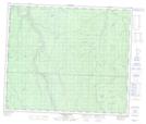
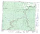
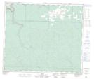
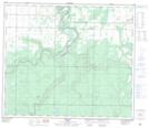
Maps showing Wapiti River, 7-71-2-W6, Alberta
Wapiti River is a River located in 7-71-2-W6, Alberta and has an elevation of 531 meters.
- Latitude: 55° 8' 18'' North (decimal: 55.1383333)
- Longitude: 118° 18' 16'' West (decimal: -118.3044444)
- Topography Feature Category: River
- Geographical Feature: River
- Canadian Province/Territory: Alberta
- Elevation: 531 meters
- Location: 7-71-2-W6
- Atlas of Canada Locator Map: Wapiti River
- GPS Coordinate Locator Map: Wapiti River Lat/Long
Wapiti River NTS Map Sheets
083L12 Lingrell Lake Topographic Map at 1:50,000 scale
083L13 Calahoo Creek Topographic Map at 1:50,000 scale
083L14 Wapiti Topographic Map at 1:50,000 scale
083M01 Debolt Topographic Map at 1:50,000 scale
083M02 Grande Prairie Topographic Map at 1:50,000 scale
083M03 Wembley Topographic Map at 1:50,000 scale
083L Wapiti Topographic Map at 1:250,000 scale
083M Grande Prairie Topographic Map at 1:250,000 scale