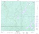
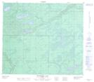
Maps showing Wappau Lake, 75-10,11-W4, Alberta
Wappau Lake is a Lake located in 75-10,11-W4, Alberta and has an elevation of 646 meters.
- Latitude: 55° 30' 18'' North (decimal: 55.5049999)
- Longitude: 111° 35' 27'' West (decimal: -111.5908332)
- Topography Feature Category: Lake
- Geographical Feature: Lake
- Canadian Province/Territory: Alberta
- Elevation: 646 meters
- Location: 75-10,11-W4
- Atlas of Canada Locator Map: Wappau Lake
- GPS Coordinate Locator Map: Wappau Lake Lat/Long
Wappau Lake NTS Map Sheets