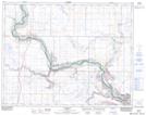
Maps showing Wardlow, 25-22-12-W4, Alberta
Wardlow is a Unincorporated area located in 25-22-12-W4, Alberta and has an elevation of 665 meters.
- Latitude: 50° 54' 19'' North (decimal: 50.9052778)
- Longitude: 111° 32' 46'' West (decimal: -111.5461111)
- Topography Feature Category: Unincorporated area
- Geographical Feature: Locality
- Canadian Province/Territory: Alberta
- Elevation: 665 meters
- Location: 25-22-12-W4
- Atlas of Canada Locator Map: Wardlow
- GPS Coordinate Locator Map: Wardlow Lat/Long
Wardlow NTS Map Sheets