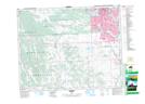
Maps showing Turner, 21-23-1-W5, Alberta
Turner is a Unincorporated area located in 21-23-1-W5, Alberta.
- Latitude: 50° 58' 41'' North (decimal: 50.9780555)
- Longitude: 114° 4' 26'' West (decimal: -114.0738888)
- Topography Feature Category: Unincorporated area
- Geographical Feature: Railway Point
- Canadian Province/Territory: Alberta
- Location: 21-23-1-W5
- Atlas of Canada Locator Map: Turner
- GPS Coordinate Locator Map: Turner Lat/Long
Turner NTS Map Sheets