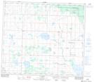
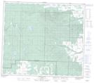
Maps showing Webber Creek, 7-74-8-W6, Alberta
Webber Creek is a River located in 7-74-8-W6, Alberta and has an elevation of 732 meters.
- Latitude: 55° 23' 46'' North (decimal: 55.3961110)
- Longitude: 119° 13' 39'' West (decimal: -119.2275000)
- Topography Feature Category: River
- Geographical Feature: Creek
- Canadian Province/Territory: Alberta
- Elevation: 732 meters
- Location: 7-74-8-W6
- Atlas of Canada Locator Map: Webber Creek
- GPS Coordinate Locator Map: Webber Creek Lat/Long
Webber Creek NTS Map Sheets