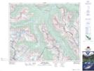
Maps showing West Glacier, 33-21,22-W5, Alberta
West Glacier is a Glacier located in 33-21,22-W5, Alberta and has an elevation of 2715 meters.
- Latitude: 51° 51' 31'' North (decimal: 51.8586110)
- Longitude: 116° 58' 55'' West (decimal: -116.9819444)
- Topography Feature Category: Glacier
- Geographical Feature: Glacier
- Canadian Province/Territory: Alberta
- Elevation: 2715 meters
- Location: 33-21,22-W5
- Atlas of Canada Locator Map: West Glacier
- GPS Coordinate Locator Map: West Glacier Lat/Long
West Glacier NTS Map Sheets