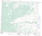
Maps showing Kamisak Lake, 71-12-W6, Alberta
Kamisak Lake is a Lake located in 71-12-W6, Alberta and has an elevation of 824 meters.
- Latitude: 55° 9' 42'' North (decimal: 55.1616666)
- Longitude: 119° 45' 8'' West (decimal: -119.7522222)
- Topography Feature Category: Lake
- Geographical Feature: Lake
- Canadian Province/Territory: Alberta
- Elevation: 824 meters
- Location: 71-12-W6
- Atlas of Canada Locator Map: Kamisak Lake
- GPS Coordinate Locator Map: Kamisak Lake Lat/Long
Kamisak Lake NTS Map Sheets