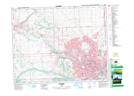
Maps showing Willingdon Hill, 24-2-W5, Alberta
Willingdon Hill is a Mountain located in 24-2-W5, Alberta and has an elevation of 1199 meters.
- Latitude: 51° 1' 48'' North (decimal: 51.0300000)
- Longitude: 114° 11' 54'' West (decimal: -114.1983333)
- Topography Feature Category: Mountain
- Geographical Feature: Hill
- Canadian Province/Territory: Alberta
- Elevation: 1199 meters
- Location: 24-2-W5
- Atlas of Canada Locator Map: Willingdon Hill
- GPS Coordinate Locator Map: Willingdon Hill Lat/Long