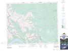
Maps showing Palliser Range, 27,28-11,12-W5, Alberta
Palliser Range is a Mountain located in 27,28-11,12-W5, Alberta and has an elevation of 2761 meters.
- Latitude: 51° 23' North (decimal: 51.3833000)
- Longitude: 115° 34' West (decimal: -115.5667000)
- Topography Feature Category: Mountain
- Geographical Feature: Range
- Canadian Province/Territory: Alberta
- Elevation: 2761 meters
- Location: 27,28-11,12-W5
- Atlas of Canada Locator Map: Palliser Range
- GPS Coordinate Locator Map: Palliser Range Lat/Long
Palliser Range NTS Map Sheets