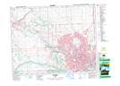
Maps showing Keith, 5-25-2-W5, Alberta
Keith is a Unincorporated area located in 5-25-2-W5, Alberta and has an elevation of 1092 meters.
- Latitude: 51° 6' 4'' North (decimal: 51.1011110)
- Longitude: 114° 14' 11'' West (decimal: -114.2363888)
- Topography Feature Category: Unincorporated area
- Geographical Feature: Locality
- Canadian Province/Territory: Alberta
- Elevation: 1092 meters
- Location: 5-25-2-W5
- Atlas of Canada Locator Map: Keith
- GPS Coordinate Locator Map: Keith Lat/Long