Maps showing Kevisville, 25-35-4-W5, Alberta
Kevisville is a Unincorporated area located in 25-35-4-W5, Alberta and has an elevation of 985 meters.
- Latitude: 52° 1' 41'' North (decimal: 52.0280555)
- Longitude: 114° 25' 54'' West (decimal: -114.4316667)
- Topography Feature Category: Unincorporated area
- Geographical Feature: Locality
- Canadian Province/Territory: Alberta
- Elevation: 985 meters
- Location: 25-35-4-W5
- Atlas of Canada Locator Map: Kevisville
- GPS Coordinate Locator Map: Kevisville Lat/Long
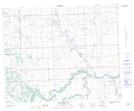
Kevisville NTS Map Sheets