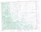
Maps showing Devil's Bite, 1-16-4 5W, Alberta
Devil's Bite is a Valley located in 1-16-4 5W, Alberta.
- Latitude: 50° 18' 51'' North (decimal: 50.3141666)
- Longitude: 114° 25' 40'' West (decimal: -114.4277778)
- Topography Feature Category: Valley
- Geographical Feature: Gap
- Canadian Province/Territory: Alberta
- Location: 1-16-4 5W
- Atlas of Canada Locator Map: Devil's Bite
- GPS Coordinate Locator Map: Devil's Bite Lat/Long
Devil's Bite NTS Map Sheets