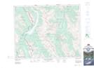
Maps showing Burstall Pass, Alberta
Burstall Pass is a Valley located in Alberta and has an elevation of 2309 meters.
- Latitude: 50° 45' 42'' North (decimal: 50.7616666)
- Longitude: 115° 22' 32'' West (decimal: -115.3755555)
- Topography Feature Category: Valley
- Geographical Feature: Pass
- Canadian Province/Territory: Alberta
- Elevation: 2309 meters
- Atlas of Canada Locator Map: Burstall Pass
- GPS Coordinate Locator Map: Burstall Pass Lat/Long
Burstall Pass NTS Map Sheets