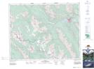
Maps showing Cory Pass, Alberta
Cory Pass is a Valley located in Alberta and has an elevation of 2363 meters.
- Latitude: 51° 12' 16'' North (decimal: 51.2044444)
- Longitude: 115° 40' 38'' West (decimal: -115.6772222)
- Topography Feature Category: Valley
- Geographical Feature: Pass
- Canadian Province/Territory: Alberta
- Elevation: 2363 meters
- Atlas of Canada Locator Map: Cory Pass
- GPS Coordinate Locator Map: Cory Pass Lat/Long