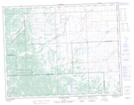
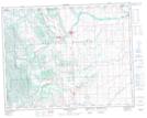
Maps showing Coal Coulee, 6-18-2-W5, Alberta
Coal Coulee is a Valley located in 6-18-2-W5, Alberta.
- Latitude: 50° 30' 24'' North (decimal: 50.5067499)
- Longitude: 114° 13' 40'' West (decimal: -114.2278609)
- Topography Feature Category: Valley
- Geographical Feature: Coulee
- Canadian Province/Territory: Alberta
- Location: 6-18-2-W5
- Atlas of Canada Locator Map: Coal Coulee
- GPS Coordinate Locator Map: Coal Coulee Lat/Long
Coal Coulee NTS Map Sheets