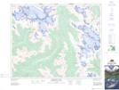
Maps showing Mount Habel, Alberta
Mount Habel is a Mountain located in Alberta and has an elevation of 2870 meters.
- Latitude: 51° 39' 14'' North (decimal: 51.6538888)
- Longitude: 116° 34' 7'' West (decimal: -116.5686111)
- Topography Feature Category: Mountain
- Geographical Feature: Mount
- Canadian Province/Territory: Alberta
- Elevation: 2870 meters
- Atlas of Canada Locator Map: Mount Habel
- GPS Coordinate Locator Map: Mount Habel Lat/Long
Mount Habel NTS Map Sheets