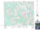
Maps showing Brewster Glacier, Alberta
Brewster Glacier is a Glacier located in Alberta and has an elevation of 2562 meters.
- Latitude: 50° 58' 3'' North (decimal: 50.9675000)
- Longitude: 115° 32' 25'' West (decimal: -115.5402778)
- Topography Feature Category: Glacier
- Geographical Feature: Glacier
- Canadian Province/Territory: Alberta
- Elevation: 2562 meters
- Atlas of Canada Locator Map: Brewster Glacier
- GPS Coordinate Locator Map: Brewster Glacier Lat/Long
Brewster Glacier NTS Map Sheets