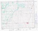
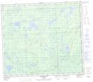
Maps showing Schrader's Hill, 5-33-3-W5, Alberta
Schrader's Hill is a Mountain located in 5-33-3-W5, Alberta.
- Latitude: 51° 47' 45'' North (decimal: 51.7958333)
- Longitude: 114° 24' 00'' West (decimal: -114.3999999)
- Topography Feature Category: Mountain
- Geographical Feature: Hill
- Canadian Province/Territory: Alberta
- Location: 5-33-3-W5
- Atlas of Canada Locator Map: Schrader's Hill
- GPS Coordinate Locator Map: Schrader's Hill Lat/Long
Schrader's Hill NTS Map Sheets